
Tags
The trip to the Wedge had involved many miles of driving for me, an air flight for my friend that joined me in Salt Lake City, and then more miles driving. Then there was the chores of grocery shopping, buying items forgotten, and filling the trailer water tank in Huntington. When we reached the Wedge the land cried out for us to slow down. It held on to us. We found our campsite and settled in for two nights.
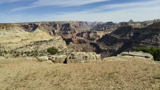
View from The Wedge
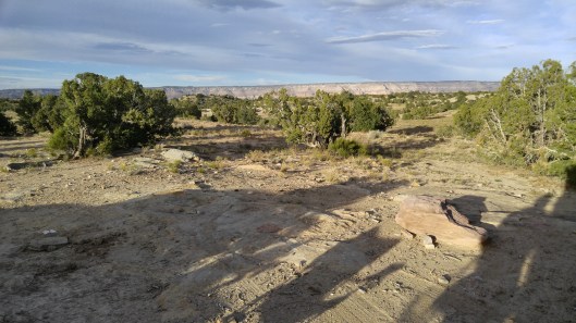
View from campsite #8.

Fossilized coral found walking along the Wedge

The northern petrograph site in Buckhorn Draw. Note the person for scale.
We drove the Buckhorn Draw and stopped at the petrograph sites. Both the rock and the drawings were impressive. Tall sandstone rock.
We ventured south of I-70 to see the Head of the Sinbad pictograph. The road was rough and slow going but it was worth it when we reached the pictograph. It is incredibly detailed and delicate.
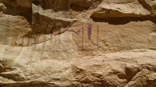
Head of the Sinbad
The Facts:
- Take a GPS with you when driving in the Swell. The roads are not all marked. We were flagged down by a couple that were lost and running low on gas. Their map wasn’t good enough to locate them.
- The best camping at The Wedge are camp sites 1 – 8.
- We passed a couple of boondocking sites after we turned off the Temple Mt. Road and headed to the Head of the Sinbad. The road was rough but large trailers had been towed into the sites.
- There are two ways to get to the Head of the Sinbad. We turned right after crossing under the freeway. Then turned left at the Y. Then look for the fence straight ahead. The road turned bad and we walked the last bit. Then we had to back up to the Y.
- We headed south on the Temple Mt. Road and found a nice lunch spot that could be camped at.
- Here is a link to my prior Wedge post.
