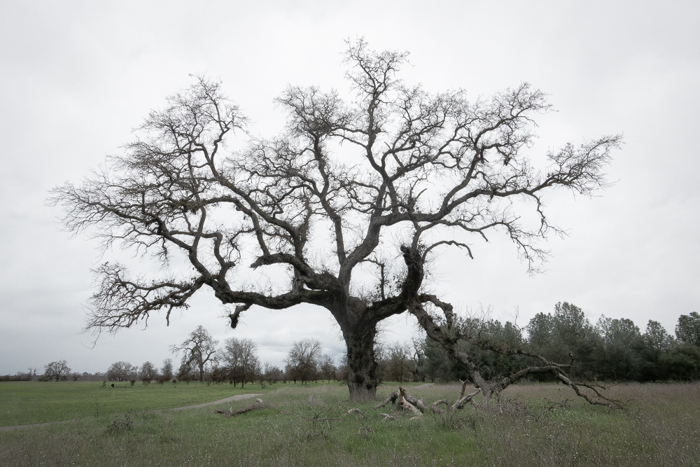
I’m a dedicated trip planner/researcher. So, I was a little surprised when I saw I would be going close to the Rainbow Basin Natural Area and knew nothing about. I had to stop and explore, and I was happy I did.


23 Saturday Mar 2024
Posted in Uncategorized
I’m a dedicated trip planner/researcher. So, I was a little surprised when I saw I would be going close to the Rainbow Basin Natural Area and knew nothing about. I had to stop and explore, and I was happy I did.
20 Wednesday Mar 2024
Posted in Uncategorized
Tags
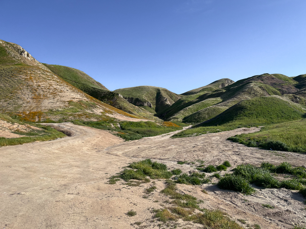
For years I had wanted to see a super bloom at Carrizo Plains. I would be somewhat close to the area, so I checked the wildflower bloom forecasts on-line. Everything I read was positive, so off I went.

15 Friday Mar 2024
Posted in Uncategorized
I was headed to Field Van in Fresno without campground reservations and soon to discover that there wasn’t a camping site within 100 miles to be had. No problem, I checked my resources and found Tumey Hills, a BLM site that allowed disperse camping. Great. I was getting tired of campgrounds.
13 Wednesday Mar 2024
Posted in Uncategorized
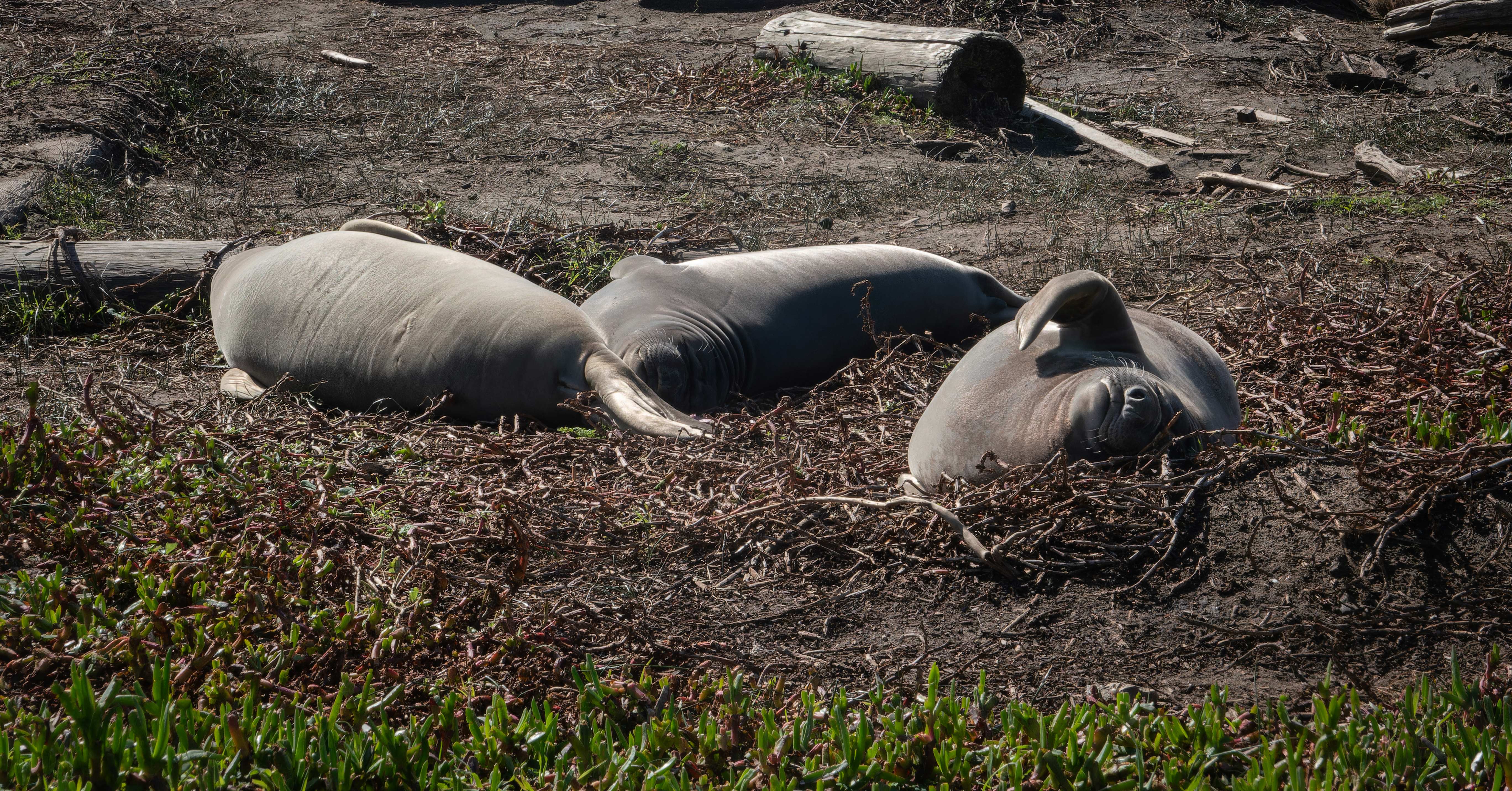
I had heard about seeing elephant seals at Point Reyes. I had to investigate. Sure enough, big males and pups where there laying on the beach. Watching them was like watching paint dry. But the outstanding docent volunteers explained the life of the seals and made the visit memorable. I will go back if I’m ever in the area.
13 Wednesday Mar 2024
Posted in Uncategorized
Tags
In my quest to get to Santa Rosa, I drove south on I-5 and turned west at Williams, CA and ventured southwest to the Doran County Park via Calistoga. I spend the night at the Sycamore Grove USFS campground by Red Bluff. I had stopped there in 2021 and found it enjoyable. It didn’t disappoint me on this trip. I walked the loop trail.
09 Saturday Mar 2024
Posted in Uncategorized
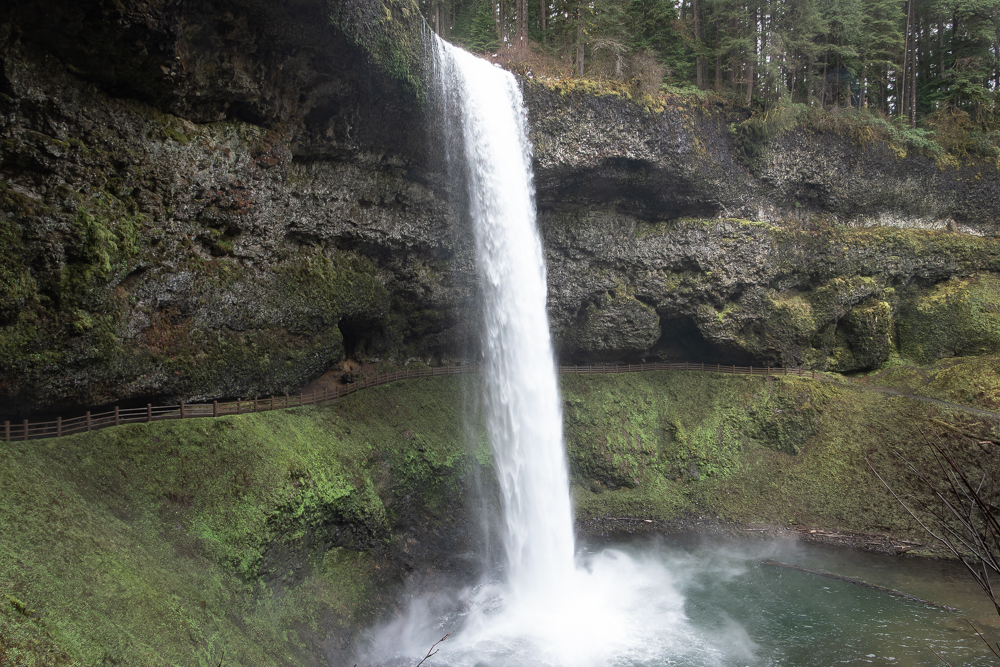
Sometimes memories are hidden away until something shakes them loose. Such were my memories of walking under and behind a waterfall. It was an intriguing experience as a child. Recently a friend described such a place to me. Silver Falls, Oregon.
08 Friday Mar 2024
Posted in Uncategorized
I headed off on my spring trip – heading south along I-5, not anywhere close to the middle of nowhere. But sometimes you have to do what you have to do. Along the way I managed to see some wonderful grist mills. Where things were powered by water and used belts and pullies to transfer the power through the mill. Ah, mechanically engineering by the common man before technology.

27 Monday Nov 2023
Posted in camping site, Winter 2023
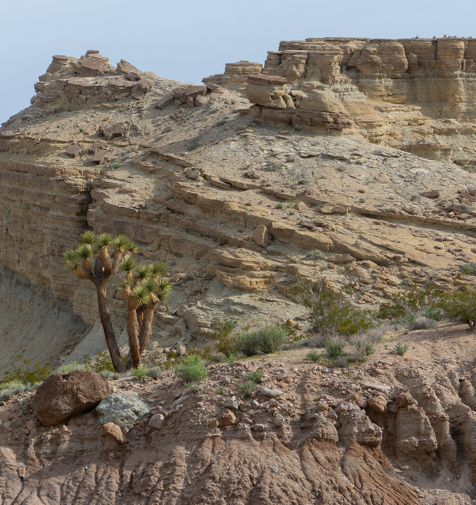
Some trips are good, others are better and exceed expectations. This trip falls into the latter category. Plans for this trip started forming with the thought that now that I have a van, it is easier to get away and I should just do it. I should try winter camping. Logic told me to stay close to the salt water where it is warmer and go when it is sunny. Hum. The day after Thanksgiving started a sunny streak of weather and Fidalgo Island (City of Anacortes, Washington area) had some ophiolite rocks I’d read about. Off I went.
20 Friday Oct 2023
Posted in Fall 2023
My last night camping was where I began – at Long Lake. Same view as before. It was Friday night and I heard music coming from across the lake where a group of friends were enjoying each other’s company. Their happiness made me smile.
17 Tuesday Oct 2023
Posted in Fall 2023
Tags
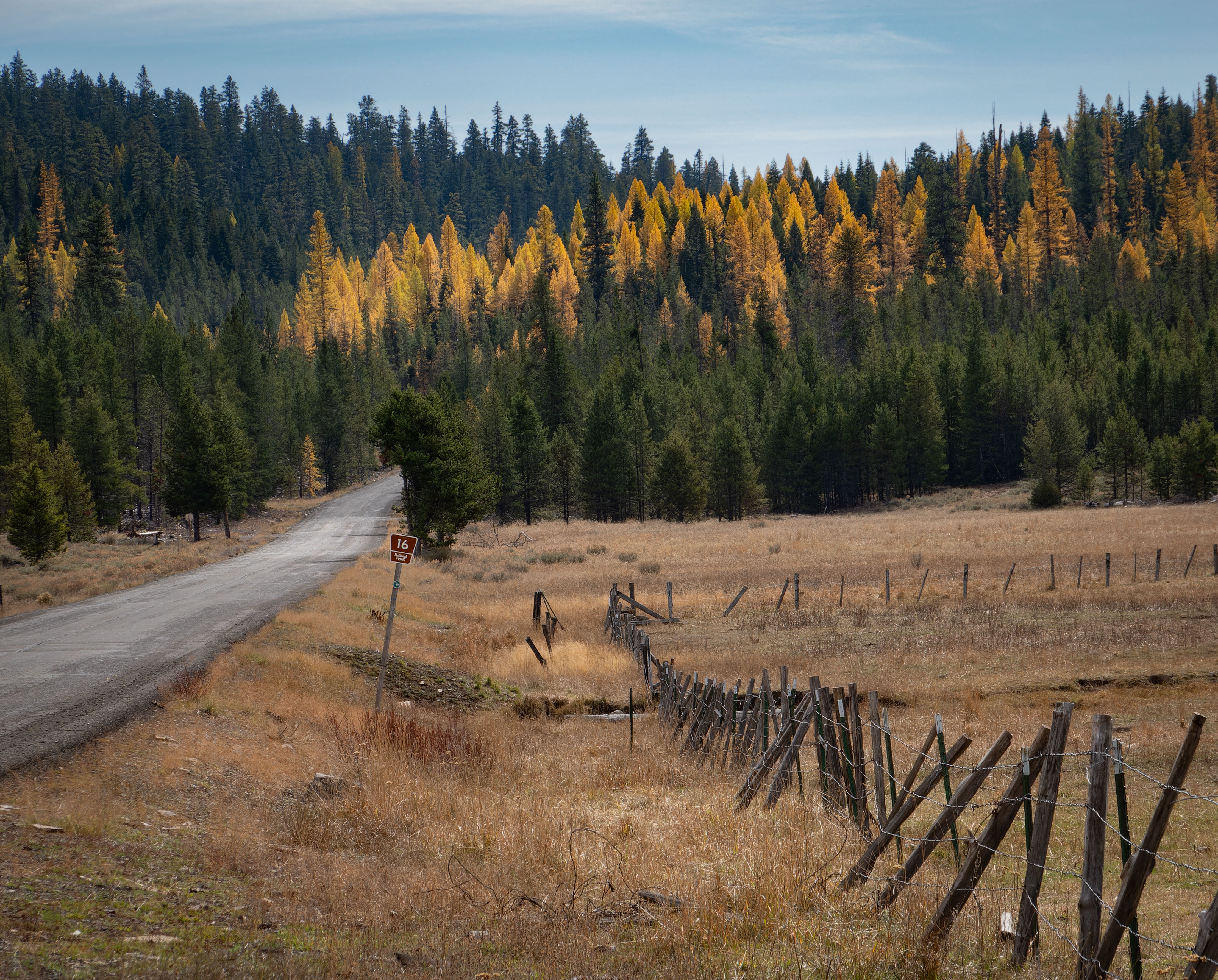
Where to go next? In looking at the map, I saw a curious feature – a paved road in what appeared to be in the middle of nowhere. Having never explored the area east of Seneca, Oregon, I decided that it was time to see what the area has to offer and drive Road 16. I explored slowly. It took me three days to drive the road.