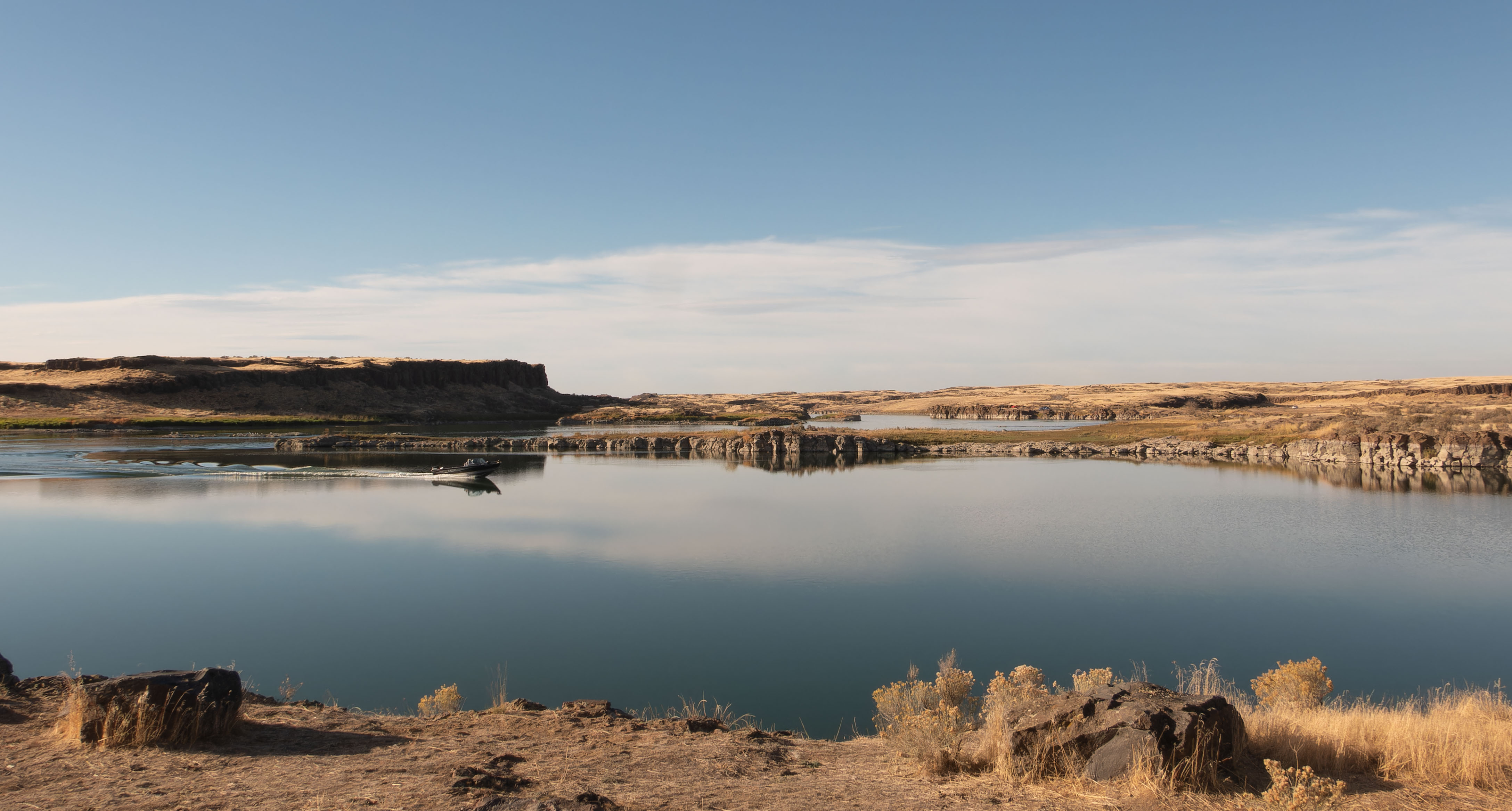
My last night camping was where I began – at Long Lake. Same view as before. It was Friday night and I heard music coming from across the lake where a group of friends were enjoying each other’s company. Their happiness made me smile.

20 Friday Oct 2023
Posted in Fall 2023
My last night camping was where I began – at Long Lake. Same view as before. It was Friday night and I heard music coming from across the lake where a group of friends were enjoying each other’s company. Their happiness made me smile.
17 Tuesday Oct 2023
Posted in Fall 2023
Tags
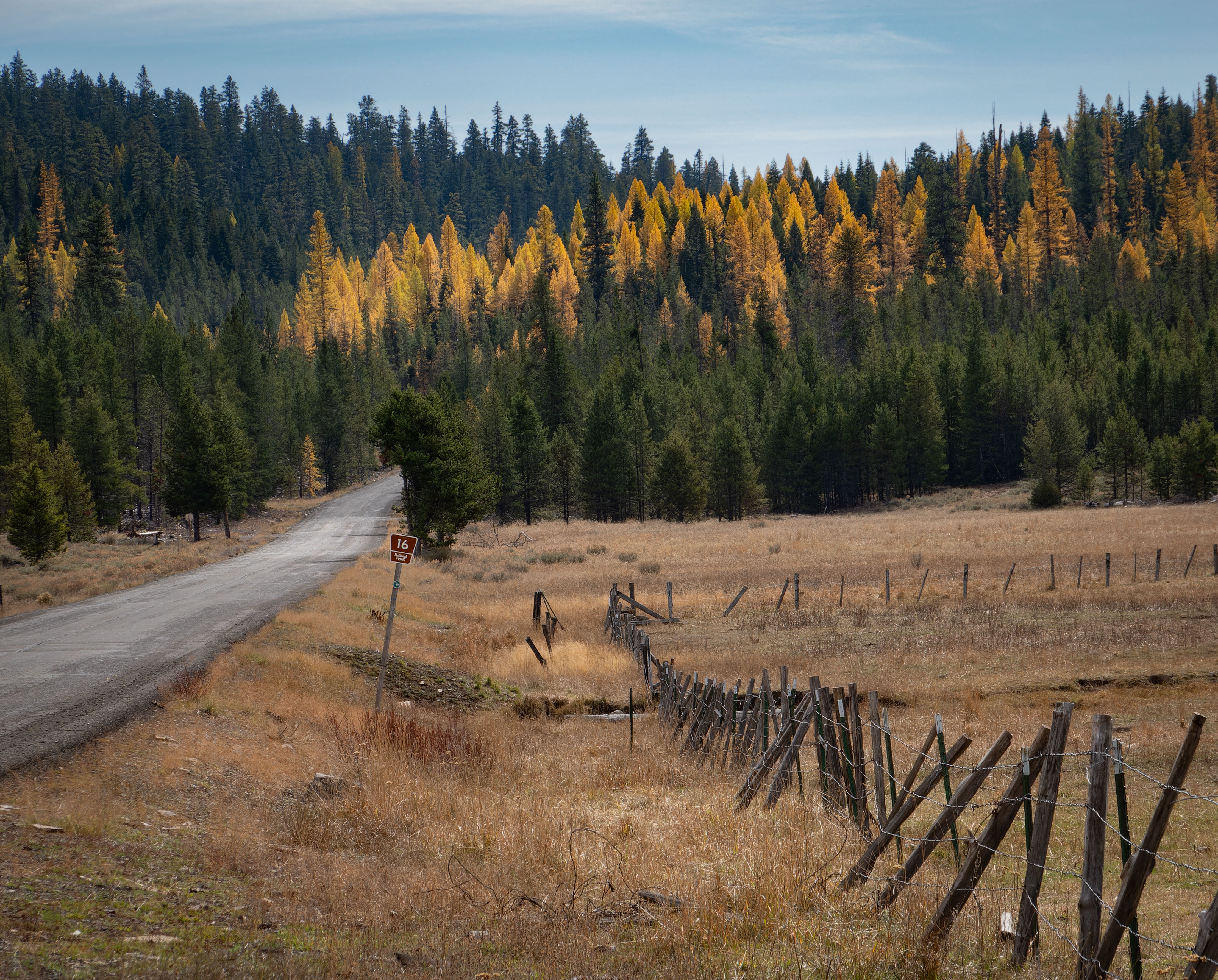
Where to go next? In looking at the map, I saw a curious feature – a paved road in what appeared to be in the middle of nowhere. Having never explored the area east of Seneca, Oregon, I decided that it was time to see what the area has to offer and drive Road 16. I explored slowly. It took me three days to drive the road.
14 Saturday Oct 2023
Posted in Fall 2023
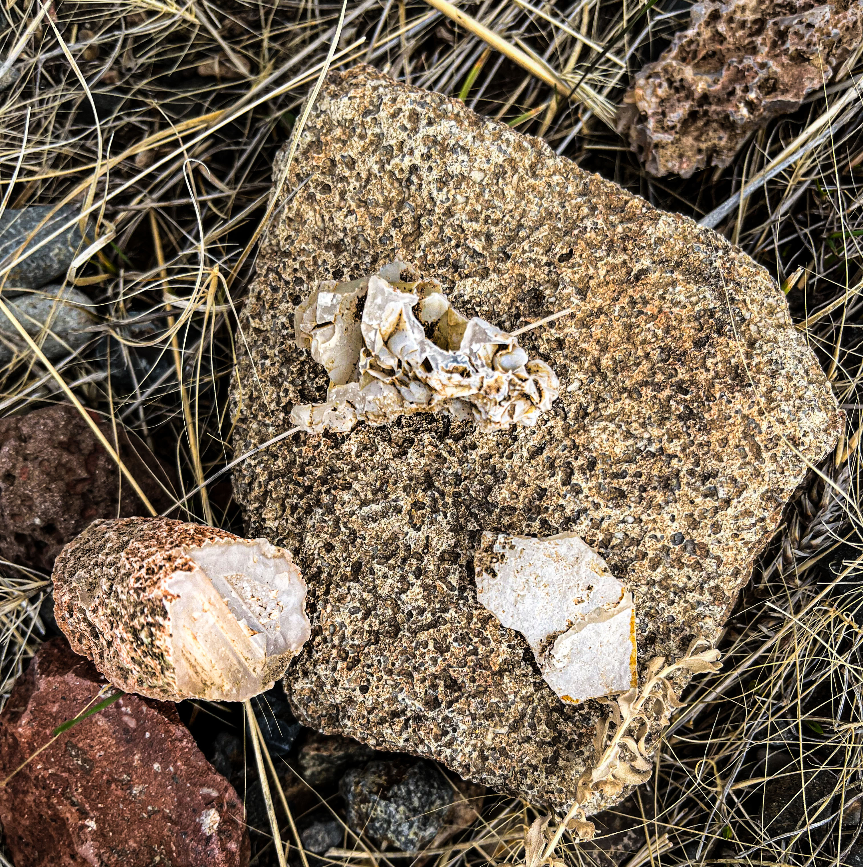
I had been uncertain about spending the effort to view the eclipse. I had heard that there may be crowds which I have an aversion to, and the weather forecast was semi cloudy. But I wanted to keep my options open, so I slowly headed west. Having some spare time, I drove the road to the Warm Springs Reservoir to look for agates and petrified wood. I found lots of agate type rock but no petrified wood. I also found some blue rocks that I have no clue what they are.
10 Tuesday Oct 2023
Posted in Fall 2023
Tags
Bruneau River Overlook, Celebration Park, Cleo's Ferry Museum, Idaho, Little City of Rocks, Map Rock, Owyhee County Museum
When leaving east central Idaho, my general plan was to head south to the Snake River and then westward to see the eclipse in Oregon. I lack a story to tell, so the following is just a collection of photos from this portion of the trip.
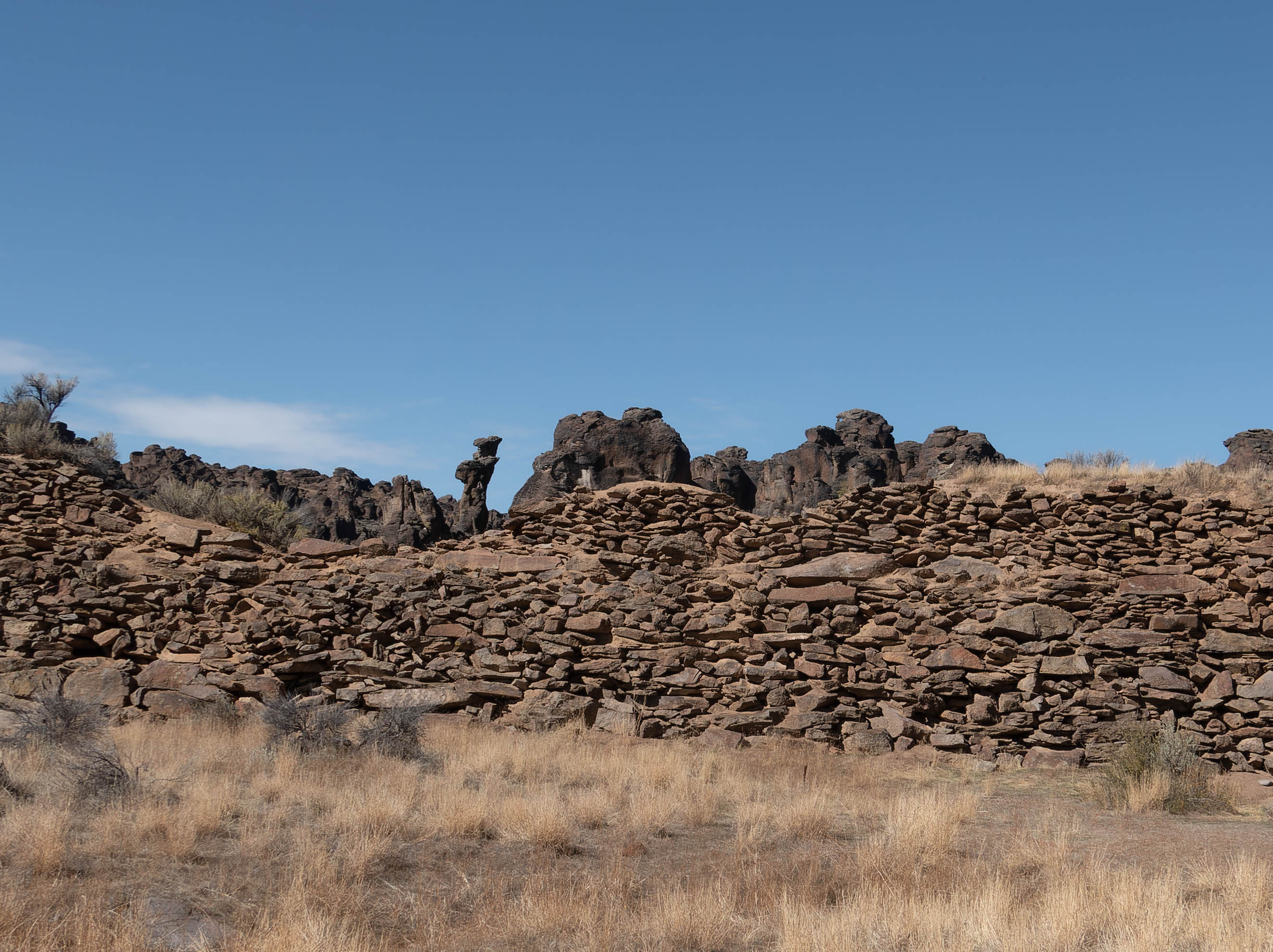
Little City of Rocks is a fun diversion west of Highway 46.
05 Thursday Oct 2023
Posted in camping site, Fall 2023, Uncategorized
Tags
Looking for a place to spend the night, I drove to the failed Teton Dam overlook. Once there, it looked vandalized. There were no signs explaining what had happen or what I was looking at. Just a paved surface, curbing and sidewalks. And then I began to understand. I was at the overlook built to showcase the dam – its ability to provide power, reduce flooding, and provide irrigation water. Now all mention of the failed dam has been removed from the overlook. There was nothing. It was as if the wish was to remove all memory of the dam. The spillway can be seen, that is the only reminder that a dam once stood there. The spillway now provides a new purpose, a surface for artists to express themselves on.

02 Monday Oct 2023
Posted in Fall 2023, Uncategorized
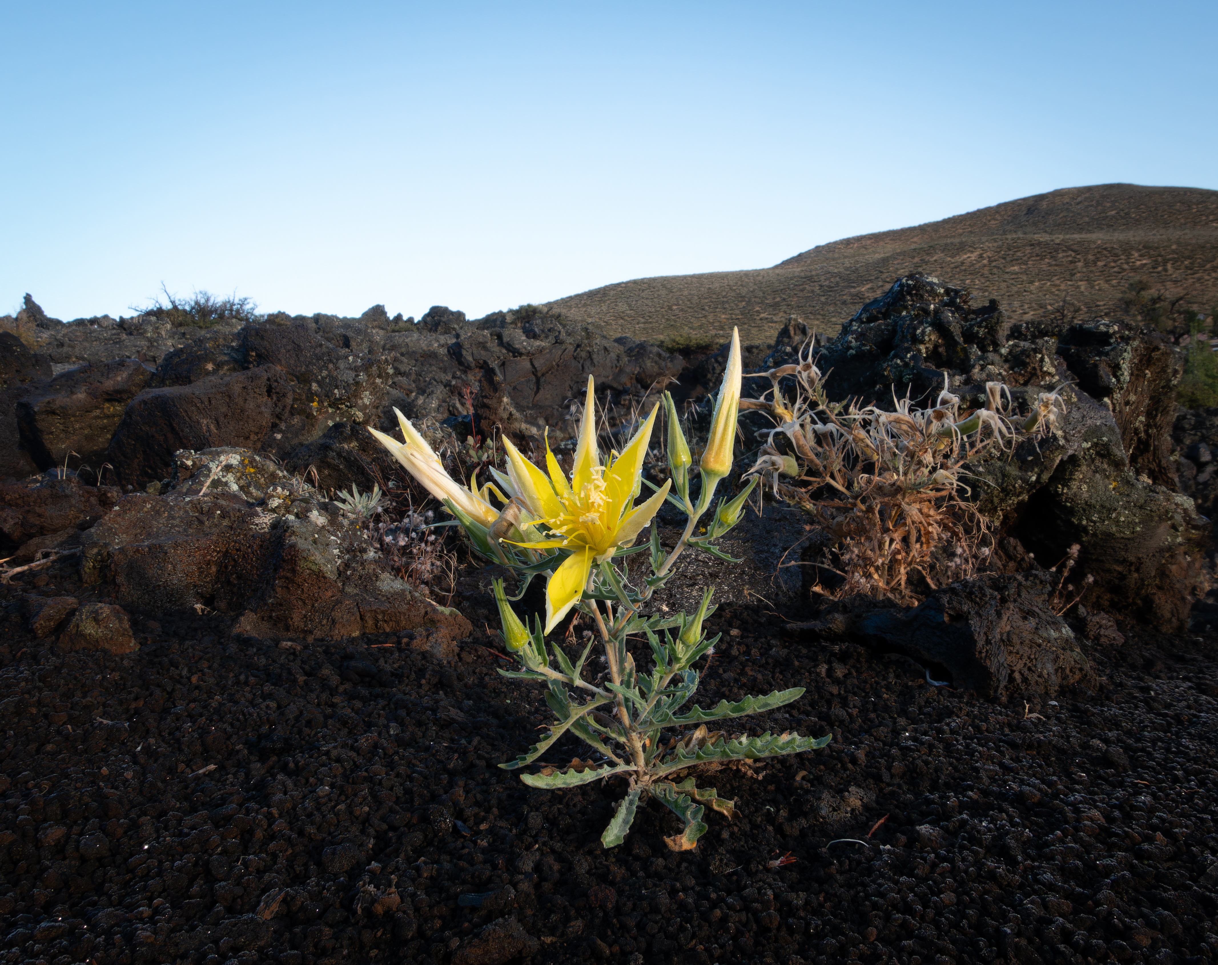
After cleaning up in Mackay, I went to the Craters of the Moon National Monument to wait out the weather. It was cold and rainy. Dogs aren’t allowed on the trails there, but they are allowed on the road. Razzy and I walked the road with my wool cap and raincoat on. The plants stood out against the black volcanic rock.
30 Saturday Sep 2023
Posted in camping site, Fall 2023
Tags
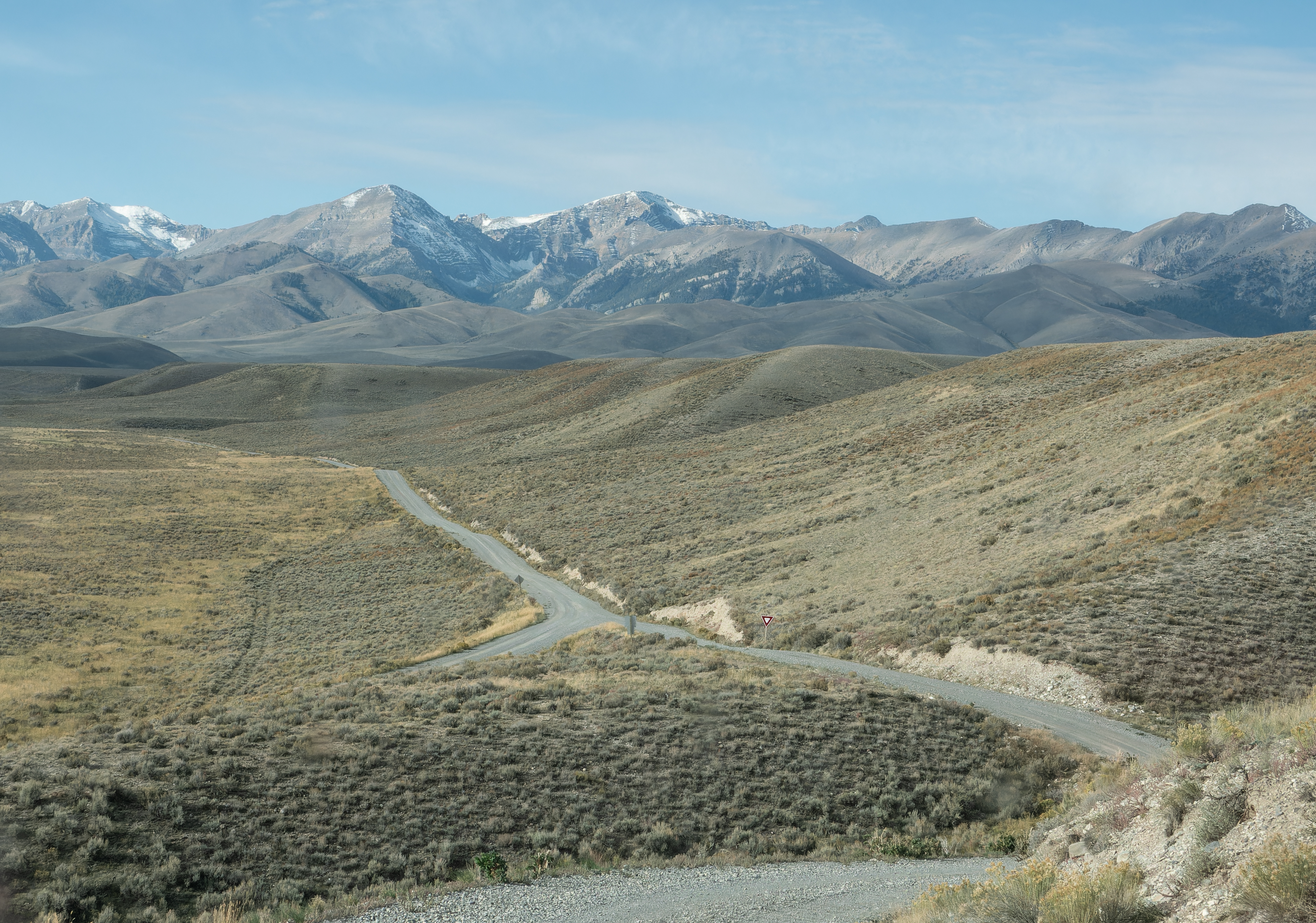
Such magnificent views. I wanted to see the mines above Mackay, so I drove the Pass Creek Road westward. It was gorgeous and the view of the road below made me chuckle. Look closely in the photo below and you will see a yield sign by the intersection. Is the yield sign needed in the middle of nowhere?
29 Friday Sep 2023
Posted in camping site, Fall 2023
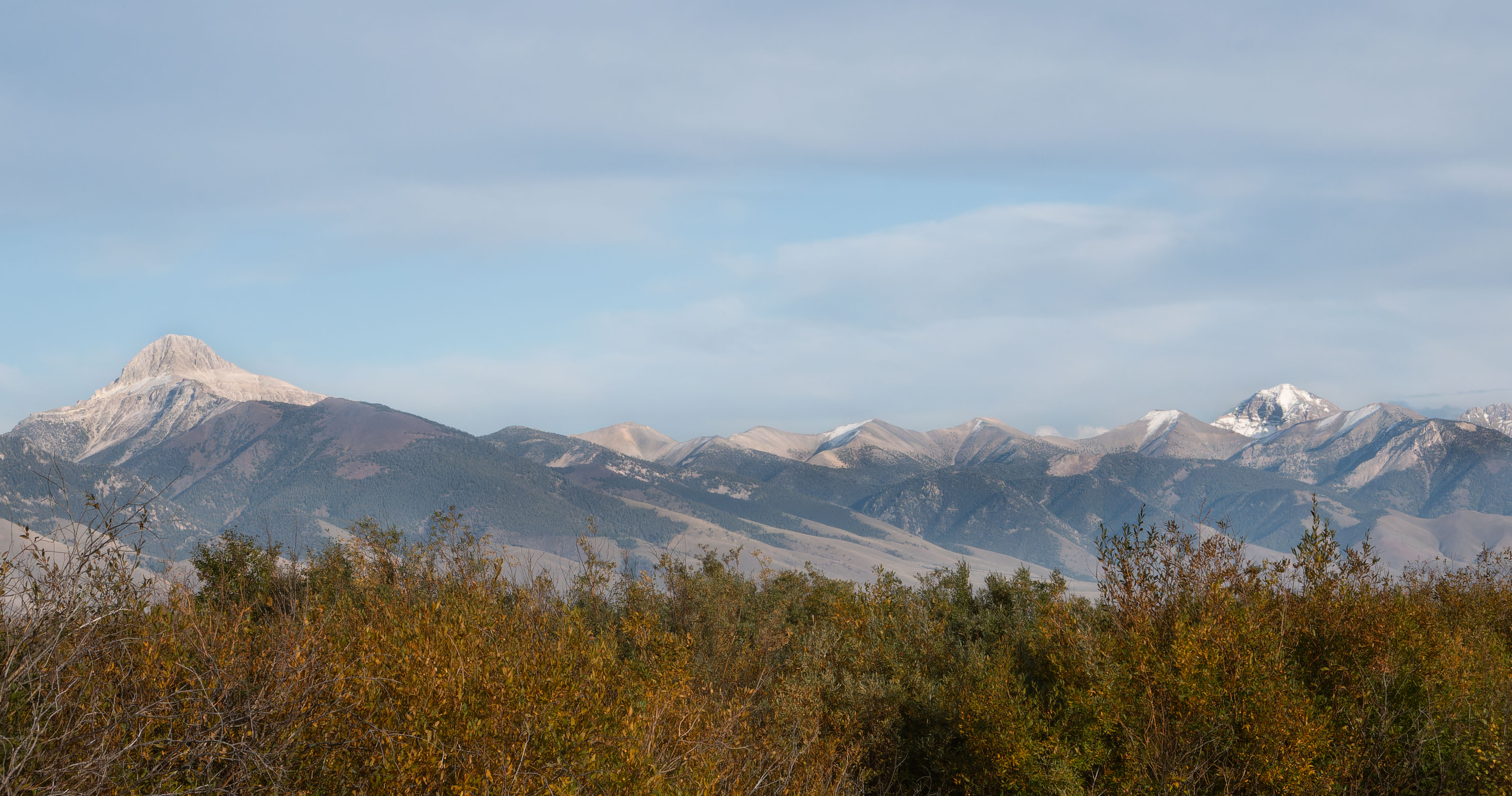
After my failed attempt to see “the most beautiful spot in Idaho” I drove on looking for a home for the night. I could have stayed at my turn around spot, but I was looking for a better view. I was being picky. And I was also enjoying the view of the Little Lost River Valley. I chose the Summit Creek Campground for my home for the night. It was a nice campground, and I was lucky that there was an auto mechanic staying there.
27 Wednesday Sep 2023
Posted in Fall 2023
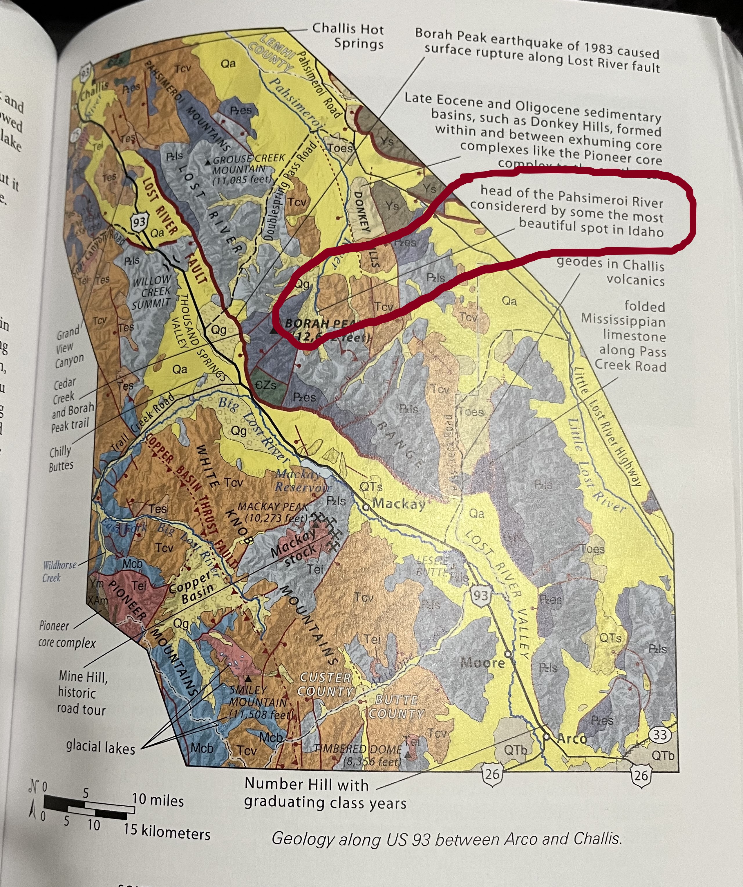
I noticed on a map in the Roadside Geology of Idaho a reference to the “most beautiful spot in Idaho”. I laughed, that was a pretty bold statement, and I was intrigued. I stopped at the Challis BLM office to find out about the road conditions to the location. They thought I could drive there, but the man helping me admitted that it had been a number of years since he had been there.
21 Thursday Sep 2023
Posted in camping site, Fall 2023
Yes! After a year of not going on a trip, I left the Pacific NW and traveled eastward. I first started by slowly going through Washington and Oregon, then I was off to explore Idaho. I was in no hurry. My first stop for the night was Long Lake a tad bit south of Mosses Lake.

