
I was raised in the Pacific Northwest. We went camping as a family when I was a kid and later on as a young adult I did lots of backpacking. It is what everyone does to some degree when you are young, living in the northwest. Being outdoors was impressed into my DNA. But now in my 50s I don’t have the same desire to backpack and sleep on the hard ground. I started researching trailers and bought a Casita. Something small that I could pull along exploring and camping on public land away from hordes of people.
Saddle Mountain on the left, Sentinel Gap in the middle
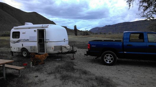
On my first trip out and my first night camping with my trailer I stumbled upon a DNR campground at the Beverly Sand Dunes close to the Columbia River south of Vantage. An absolute perfect beginning to my research looking for the middle of nowhere. One can tell that the campground was never designed, it just happened. Then DNR simply came in and added some picnic tables and porta-potties. There are no official camping sites. You just drive/walk around until you find a place you like and then you make it yours. The area seemed primarily used by OHVs playing in the sand dunes but for the two nights I spent there, there was only one other camper and no OHVs.
During the day I explored and I drove up Saddle Mountain looking for petrified wood. BLM has a map at the bottom indicating where the petrified wood sites are. I drove first to the top and jumped out of my truck to enjoy the view. Freezing cold winds hit me, not making me want to spend much time looking for petrified wood. And I had forgotten to take a picture of the BLM map locating the petrified wood sites so I didn’t know where they were. I did find small fragments of petrified wood scattered everywhere but nothing notable. I turned around and enjoy my drive down to warmer weather.
Location Facts:
- The DNR site is located on the east side of the Columbia River off of Lower Crab Creek Road.
- When the wind stops, the mosquitoes come out. Lots of them.
- Wanapum dam has a small free museum that I enjoyed visiting. Access it from the east side of the river.
- For more information on the area’s geology I recommend the book Fire, Faults & Floods by Marge & Ted Mueller.
- To drive up the west end of Saddle Mountain turn north off of 24 SW Road onto R road close to the town of Mattawa.
- At Vantage there is the Gingko Petrified Forest interpretive center. Every time I’m in the area it is closed, so I can’t give you any thoughts on the center.
