
I had recently seen pictures of the canyon formed by the Grande Ronde River slicing through layers of Columbia River flood basalt. I was astonished. I was born and raised in Washington and had never heard of the canyon. I added seeing this wonder to my to-do list. So on this trip I was headed to the southeast corner of Washington to see the canyon. I wasn’t disappointed. Ribbons of basalt from the Columbia River flood basalt were shown in various color. To me the sight was breathtaking. Driving Washington Hwy 129 and Oregon Hwy 3 I drove twisting and turning to the bottom of the canyon pausing to look along the way, and then I drove up the other side. An elevation difference of about 3,000 feet.
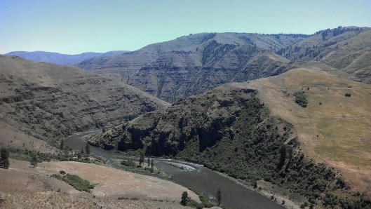
View from Hwy 129
Another view of the river and canyon is from Shumaker Road. Drive down the road and turn right (west) when you get to the bottom. After driving about a mile there is a nice area to boondocks next to the river. I wish I had known about this site on the river earlier. Not knowing anywhere to boondock I had pulled into the Field Spring campground.
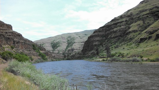
View from Shumaker Road

End of Shumaker Road
The ranger told me that an old pack trail crossed the river at the end of Shumaker Road. The tunnel through the rocks was built for the pack trail.
Location facts:
- The river is known for world class fishing.
- Access Shumaker Road about a mile north of the Fields Spring State Park off of Hwy 3.
- On Hwy 129 next to the Grande Ronde River is a nice café. The food is good and surprisingly the prices were reasonable for being in the middle of nowhere.
- Cell service was available at the Fields Spring ranger station.
