It has been almost a year since I’ve last gone camping. I decided to get a camper van and then I mistakenly sold my trailer too early, so there was no spring trip. This trip was short, just long enough to try everything, read manuals and email Field Van with somewhat dumb questions – like: “where is the light switch for the back lights”?
I headed eastward from Seattle to the Joe Watt Canyon Rd. in Lt Murray State Wildlife area.
All trips are different, and this fall trip had numerous unexpected “life happens” events which resulted in a mostly unplanned trip/route with lots of driving. Not a trip of slow exploration and searching for the middle of nowhere. And at the end of the trip, I was chased home with unending rain and snow in the forecast. Without much of a story to tell, I’ve simply shown some pictures below and included some informational facts that may help others plan a trip. The trip was October 20 – November 8.
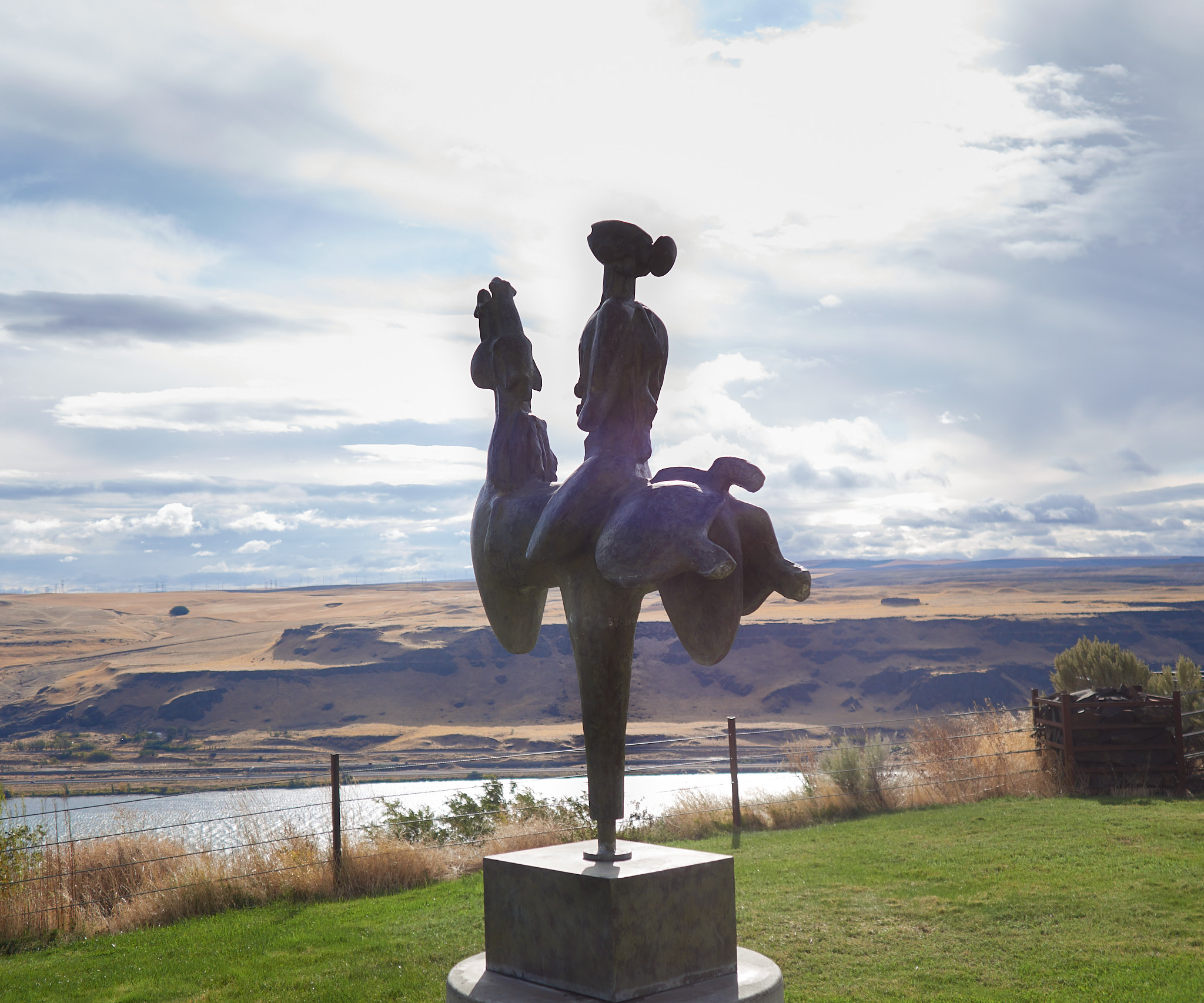
I think I have driven by the sign directing one to the Maryhill Museum at least twenty times and have never taken the time to stop. This trip I stopped to see the museum. What the museum contained was surprising and amazing. Maryhill Museum of Art | Fine Art in Southwest Washington And the founder of the museum; Sam Hill, was equally interesting. Samuel Hill – Wikipedia
Looking south towards the Columbia River from the Maryhill Museum Continue reading →
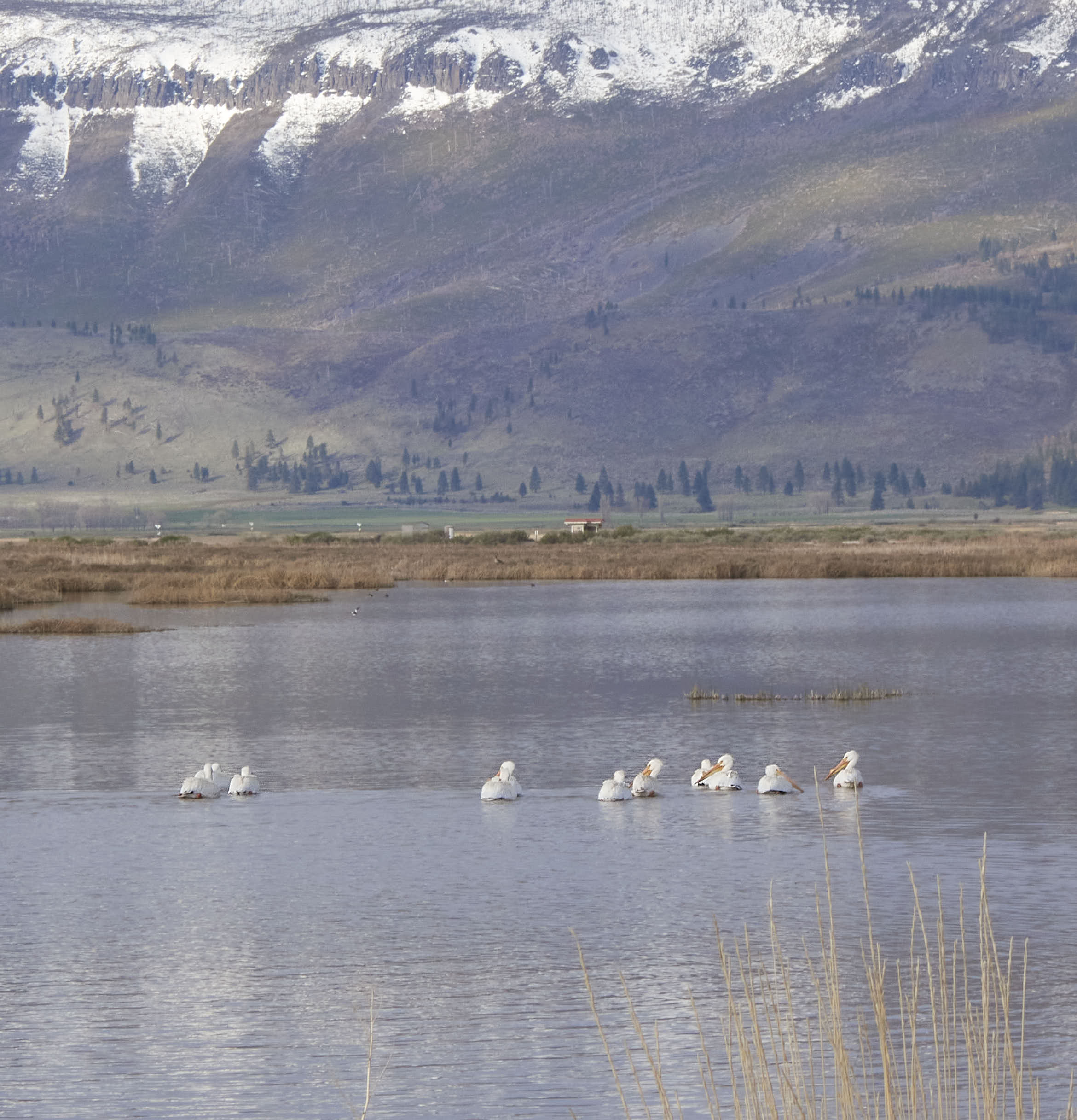
I camped at Summer Lake in 2013 and have wanted to return for years. Last fall I was planning on returning but with a weather forecast of bitter cold and snow, I aborted that plan. On this trip, on my way south I was going to stay. Instead I only saw Summer Lake as I hurriedly drove south working to keep ahead of a bitter cold front descending from the north. Now today. As I drove north I was driving through dark gray skies and snow. In places there was a couple of inches of snow covering the ground. The wind was blowing cold. I made the decision that if I could find a place to fill my propane tanks for the furnace, I would turn off the road and stay. I was able to get the propane tanks filled – I ventured to Summer Lake. It was better than I remembered.
After seeing the ancient Bristlecone Pines, I wanted to get back to Nevada. Too many people in Owens Valley. I didn’t know that Highway 395 in California was a four-lane road, that Bishop had many stoplights, and that gas stations were in all the towns. I skedaddled back to Nevada and settled in at Lahontan State Park River Campground. So much better.
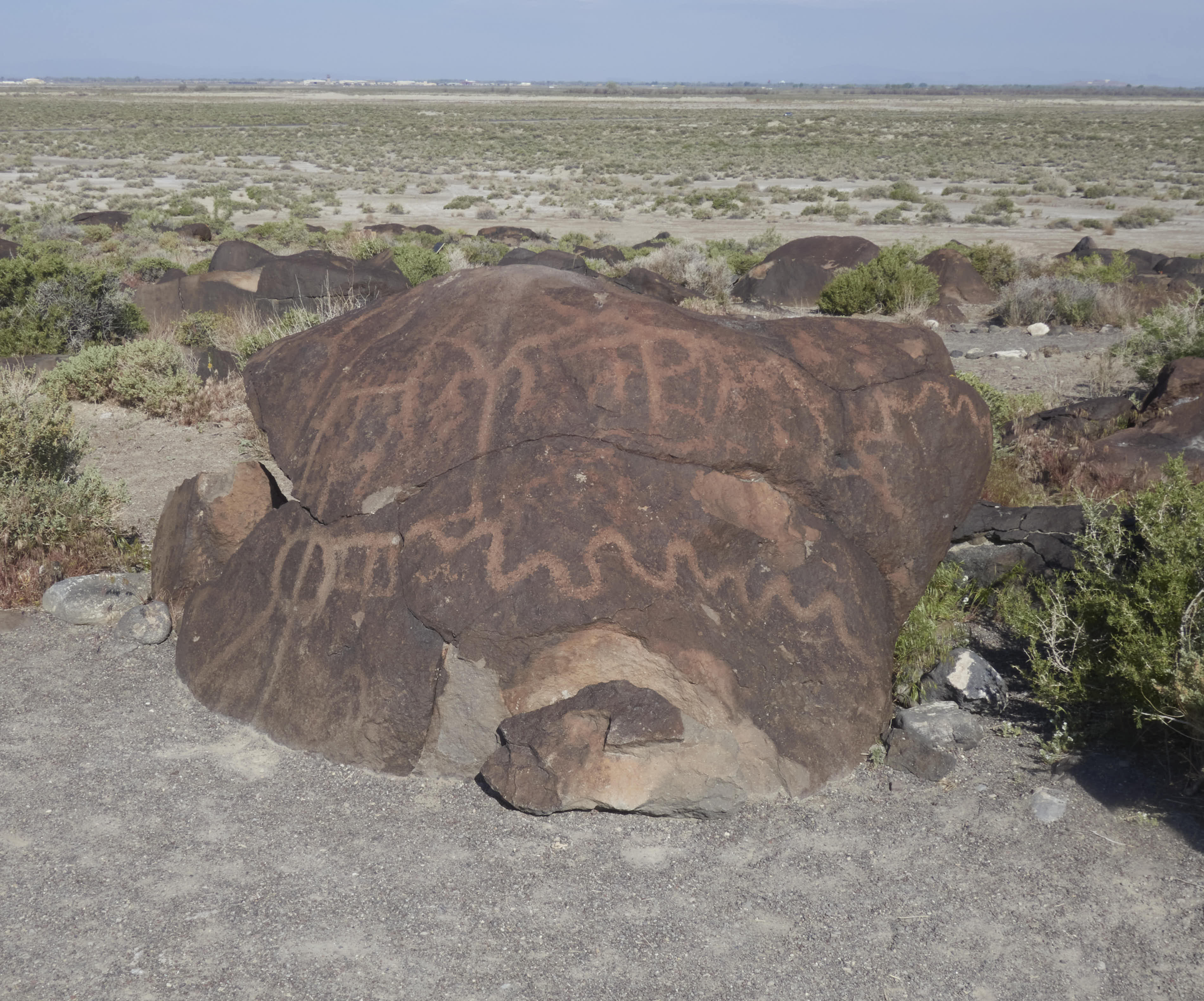
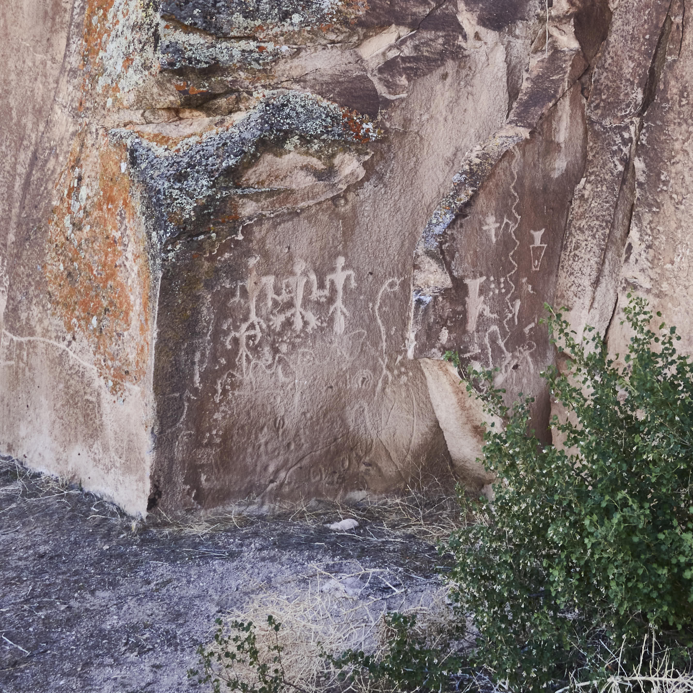
I drove over to Grimes Point to see a few things I had heard about. There is a petroglyph site that is adjacent to Highway 50 and southeast of Fallon. An easy stop. A five-minute walk and you start seeing petroglyphs. I was able to leave my old dog in the truck with the windows down and watch him as I viewed the petroglyphs.
There I was, sitting in my trailer during a dust storm in Mina, Nevada surfing the internet. And I read that someone had visited the ancient Bristlecone Pines in the White Mountains weeks ago. What? Could this be correct? It was.
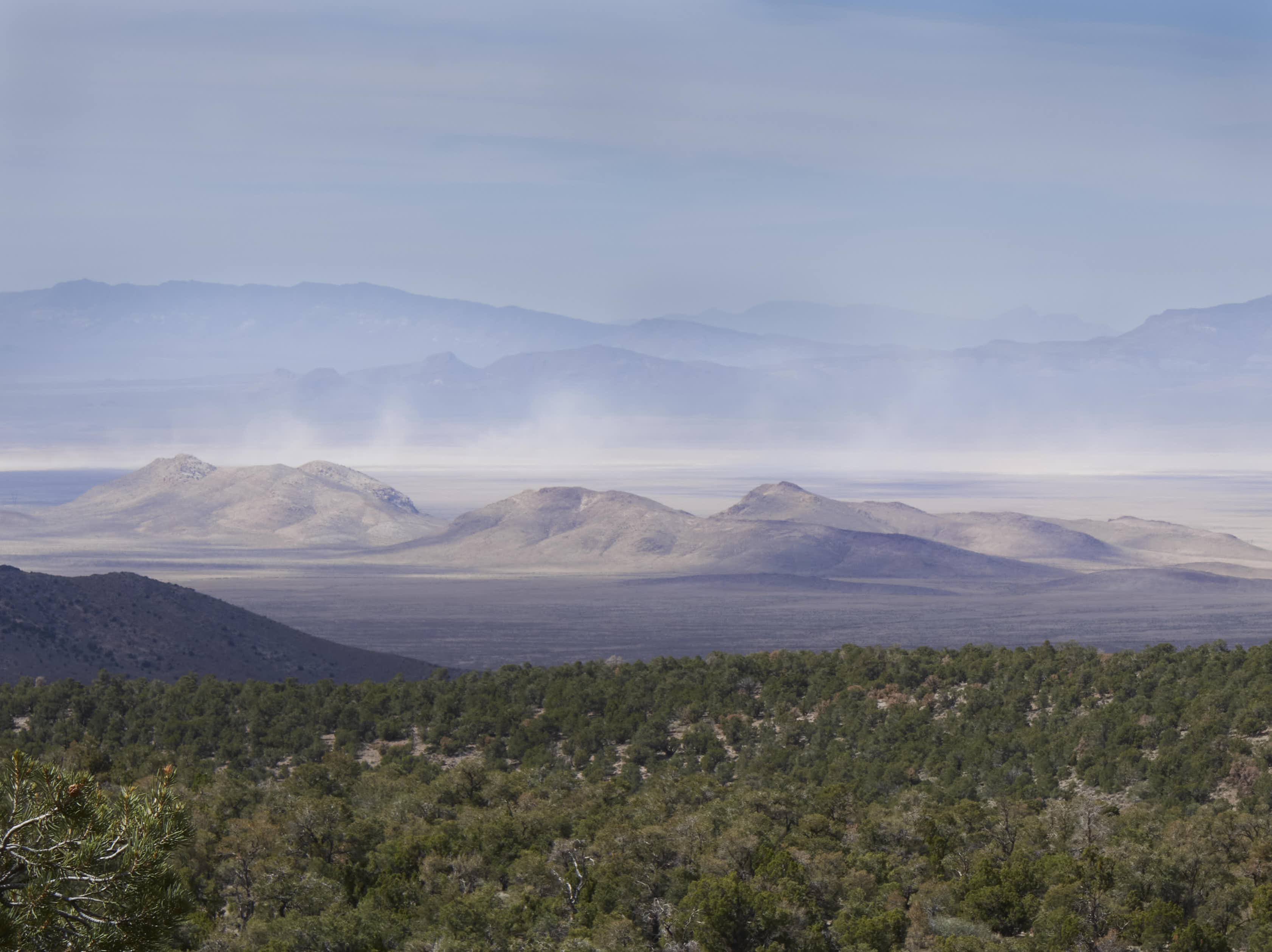
I’ve always wanted to see the ancient Bristlecone Pine trees, ever since I heard about them. They are the oldest known living plant on earth. Some are older than 4,000 years old. They live at 10,000 feet elevation where the snow doesn’t leave the roads until June usually. When I left on this trip, I didn’t think there was any possibility that I could see them. I was too early in the year for the roads to be open. And then I heard it was possible to drive to the trees. My travel plans got flipped, instead of going north, I headed south to Big Pine.
Driving east on Hwy 168 to see the pines. Photo credit Thoms G., Google Earth. Continue reading →
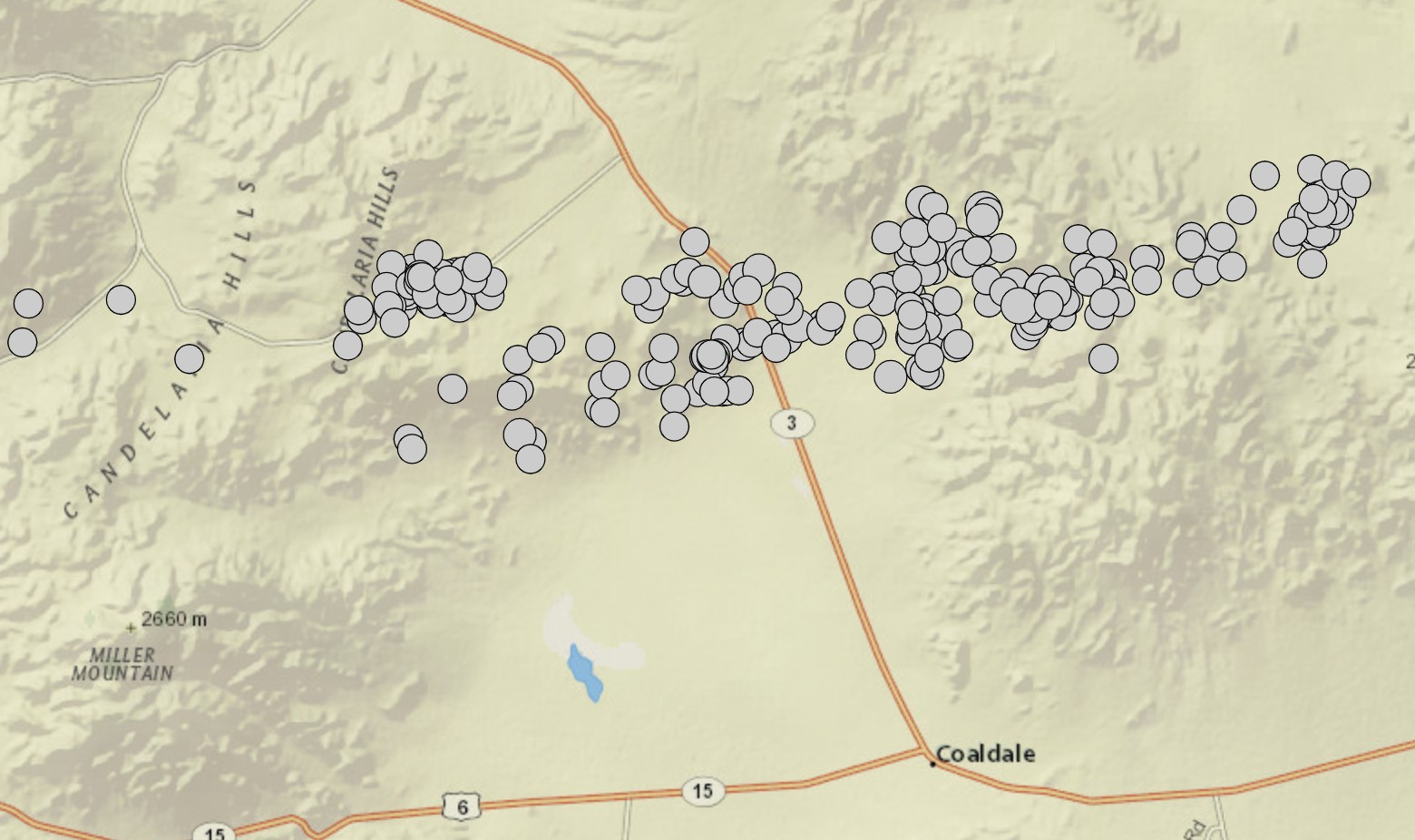
Haven’t heard of Mina? If not, you don’t watch the USGS earthquake web page. Last year it was the nearest town to an earthquake swarm of over 200 earthquakes greater that a magnitude 2.0. There was no major damage that I heard of, but the ground was rocking and rolling for months.
Above is a snip from the USGS Earthquake web site. Each dot represents an earthquake. Mina is about fifteen miles north of these earthquakes.
Going south and north were two areas I explored around Tonopah. I was surprised how much old mining activity I saw when I went north and southwest of Belmont. The hills seemed to be littered with mining explorations and the evidence of small mines. Off I went to explore an abandoned mine and surrounding area.
Following are a few miscellaneous items from my time spent around the Kershaw Ryan State Park.
I’m cautious about what roads I drive down. I look at aerials and I don’t drive a road that I see vegetation growing in the middle of the road. I ask locals about road conditions. I read about other people’s adventures. But sometimes that all fails. Lots of vegetation can grow after an eight-year-old road report indicating that a car could drive the road. Yes, technically a car could drive the road, but pin striping results. There was no place to turn around. I cringed and laughed.
After driving through Nevada last year in March, I knew I wanted to return. I left Seattle the first week of April and had a generally plan to make a counter clockwise loop of the state. But plans are made to be broken. A cold weather forecast keep getting colder and the high winds warning area grew and the projected wind velocities kept increasing. Snow entered into many forecasts. I ended up at Kershaw Ryan State Park to hunker down for the bad weather.